
Cyclists' Home Page | Davenport Station | Cycle Stockport | Stockport Council Cycling pages
These supplementary cyclist's pages are for everyone who enjoy cycling around the south Stockport area, and especially those who attend the Stockport Council Cycle User Group meetings, which are freely open to all. New faces are always welcome.
Note: this is a strictly unofficial site, not connected with or approved by Stockport Council or Northern Rail.
Created and compiled by Charlie Hulme.
It's Good to Share - thoughts on shared footways
Written by Charlie Hulme, with apologies to those who think Charlie fusses too much. Updated January 2012.
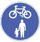 The Shared Footway (Unsegregated) sign
(left) is becoming a common sight in Stockport, even though it does not
currently appear on the Highway Code website, and the concept is only
briefly mentioned in the 'rules for cyclists.' To my mind, however, it
is problematic, as it does not apparently have a matching 'end' marker.
I notice that in Trafford the rather ugly 'Cyclists Dismount' sign has
been used in places, but clearly this is not appropriate, as rather
than dismounting, all that is needed is to return to the roadway. Also,
it is not always clear to pedestrians that they are on a shared route -
perhaps this is not considered necessary since cyclists must give way
to pedestrians? Below are some recent pictures illistrating the theme.
The Shared Footway (Unsegregated) sign
(left) is becoming a common sight in Stockport, even though it does not
currently appear on the Highway Code website, and the concept is only
briefly mentioned in the 'rules for cyclists.' To my mind, however, it
is problematic, as it does not apparently have a matching 'end' marker.
I notice that in Trafford the rather ugly 'Cyclists Dismount' sign has
been used in places, but clearly this is not appropriate, as rather
than dismounting, all that is needed is to return to the roadway. Also,
it is not always clear to pedestrians that they are on a shared route -
perhaps this is not considered necessary since cyclists must give way
to pedestrians? Below are some recent pictures illistrating the theme.Bramhall Green
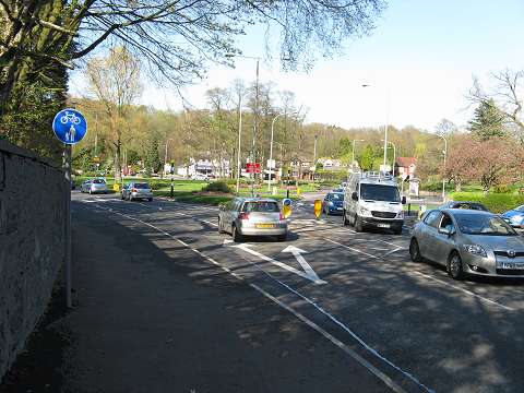
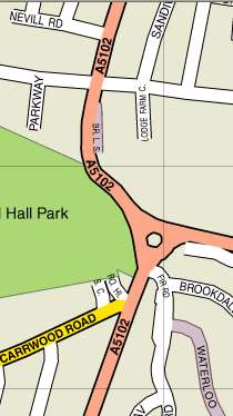
The first set of pictures shows the new layout at Bramhall Green roundabout (see map, left). Picture 1 (above) shows the view approaching from Carrwood Road. The sign shown in the first indication of a shared footway. A dropped kerb has been installed since this article was first written.
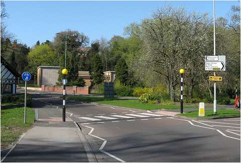
Picture 2 is a little further round the corner, with Bramhall Lane South heading up the hill towards Davenport in the distance. The drive of Bramhall Hall is to the left just beyond the black-and-white building. The sign shown is the last sign I will see if I am heading towards Davenport; does it mean I can continue on the pavement all the way up the hill and on to Davenport? Probably not, but how do I know? Can I cycle across the zebra crossing? No, I need to get off according to our Cycling Officer. (There is a proposal for a new type of 'Tiger' crossing which would be yellow and black and would allow this, but it has not passed into law.) There is another set of 'dropped kerbs' just by the building which I can use to cross if I am headed east towards Hazel Grove. This is the best way for cyclists.
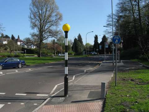
This view looks back from the zebra crossing shown above towards the same sign. Note that it is double-sided. I think there should be some sort of markings on the pavement which clearly indicate to both pedestrians and cyclists the start and end of these shared footways.
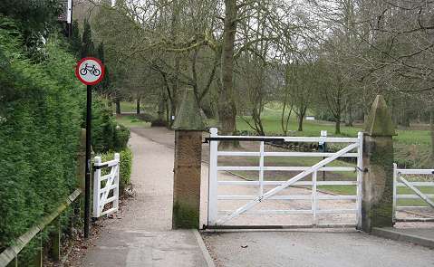
Incidentally, what if I fancy cycling up the drive to the Hall, owned by Stockport Council and even used by motor vehicles on special occasions. Update: the sign has been removed and cycling is apparently, although there is nothing on the site to show this.
Winifred Road Scenes
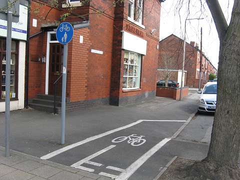
This is the junction of Winifred Road and Bramhall Lane in Davenport shopping centre. Motor vehicle access to Winifred Road is closed off at this end, but cyclists are allowed to mount the footway and pass through. Oddly, the 'unsegregated' sign appears to have been used for a segregated path (mind your handlebars don't catch that post though!) - but my guess is that the 'unsegregated' bit refers to the passage across the pavement from Bramhall Lane where I was standing when I took this picture.
Adjacent to the other end of Winifred Road where it joins the A6 road, there is a 'Toucan Crossing' on the main road which is available to both cyclists and pedestrians. Very good, but how do I reach it on my bike? There's nothing to say I can cycle on the footway here, on either side. Do I have to get off and walk to the crossing, cycle across it? This is a very useful route to Davenport from Stockport, avoiding the busy and narrow part of Bramhall Lane.
Behind the camera in the picture above, and round the corner into Winifred Road, looking towards Davenport, there is a shared footway (unsegregated) sign. Why would I want to cycle on the pavement along this quiet road? How far can I go along the footway? Who knows? Of could it be that the sign should in fact be facing the other way?
Ever more odd, there is another sign on the opposite side of Winifred Road, suggesting that cycling allowed on the footways on both sides of the road. I understand that this is known to be a mistake, but if so it's taking a long time to correct as these signs are far from new. Update January 2012: still no changes have been made
No end to it
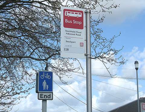
As I have said, there appears to be no policy to mark the end of a shared footway (unsegregated). And yet, on Stockholm Road near the railway bridge on the Edgeley / Adswood board, there is the sign shown above. The way in question is not directly alongside a road, so maybe has a different status. Or maybe rules were different back in 1995 when this route was laid out?
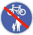
Or maybe something like this, as I have noticed in Austria? Perhaps the best suggestion would be just have something on the ground, maybe small white cycle symbols, which would also alert pedestrians to the legal presence of cyclists.
Town Hall to Edgeley
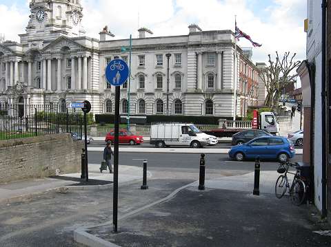
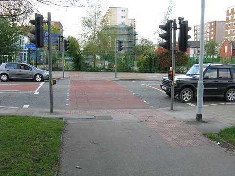
Next, the newly-improved route from the Town Hall area to Edgeley, now a connection to 'Airport' route 558. The view above looks down James Leech Street towards the A6, which can now be crossed here with the ais of a 'Toucan' crossing, although again it's not clear whether footway cycling is allowed to reach the crossing. If the sign seen here is meant to indicate this - and it could well be as a dropped kerb is provided, that's very nice, but it would be even better if there was some way that pedestrians along the A6, and cyclists coming across the A6, could be made aware that it is a shared route.
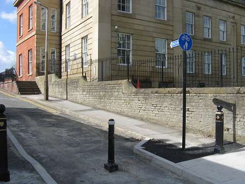
Looking up James Leech Street, where work seems to be still incomplete after months of delays. But what can that shared footway sign possibly be indicating? Should it be facing the other way? Update September 2011: The work is now complete, and nice white markings have been painted on the road surface.
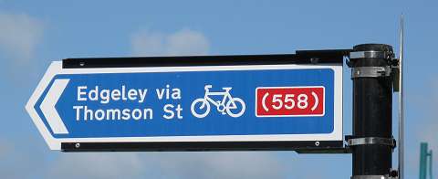
The sign on the other side of the post. The patentheses around (558) indicate that this route leads to the main Airport route 558.
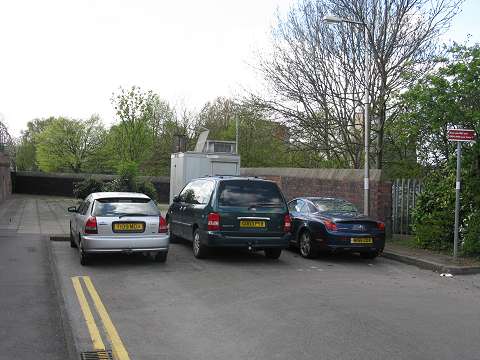
Following the route up Thomsson Street brings us to this point. A dead end? Certainly no shared footway signs or dropped kerb...
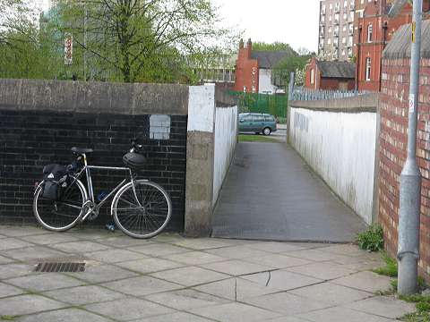
But what's this hidden behind the cars? A bridge over the railway which leads to Edgeley. Until the 1950s Thompson Street used to continue here, as the railway was in a tunnel, and this bridge was provided to maintain the right of way, which is actually shown on the Stockport Cycling Map.
At the other end is a Toucan Crossing leading to Edgeley, provided with segregated cycleways, but what about the link from the bridge to the crossing?
More sign confusion
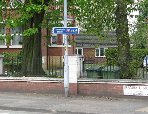
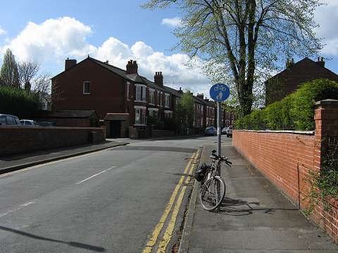
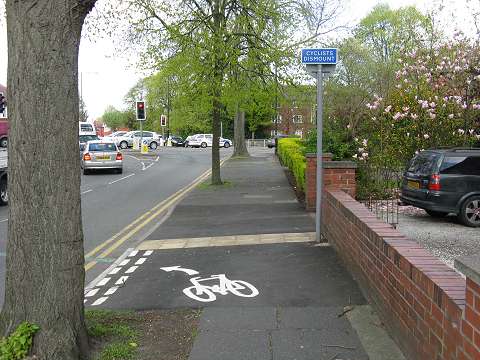
How about this type of sign, as seen on Bramhall Lane near Davenport station? Does it mean I can cycle on the pavement? No, not all, it was just that the post happened to be a convenient place to put the sign....
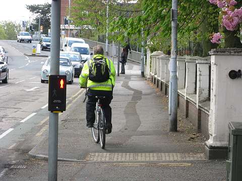
... but of course many people take no notice of rules anyway - and in this case who can blame them given the dangerous and cycle-unfriendly road layout which has been inflicted upton the Davenport station area. No, that's not me in the picture. This section of pavement could be made into a shared path, linking with the paths in Cale Green Park and avoiding a very dangerous part of Bramhall Lane.
The Trafford angle
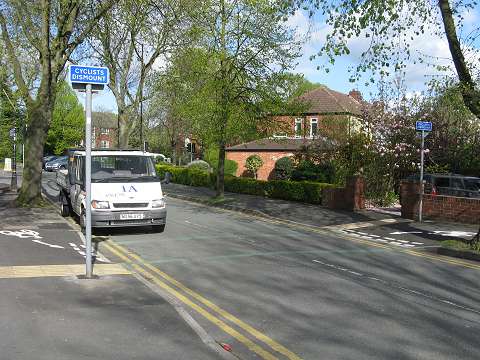
Here's a recently-installed example from Trafford, on Lime Road, Stretford, a route from the local school, showing the use of a 'Cyclists Dismount' sign to mean 'cyclists must turn off the footway here.'
A wider view of the same location showing how the shared footway continues across to the other side of the road on its way to the bridge carrying Edge Lane over the railway and canal. On the other side of the left-hand post is a 'shared footway (unsegregated)' sign ... surely it should be the other way around! This seems to be a common issue with these signs, perhaps suggesting that their meaning is so muddled that even the people who install them don't understand it...
To the Davenport station home page