
Cyclists' Home Page | Davenport Station | Cycle Stockport | Stockport Council Cycling pages
These supplementary cyclist's pages are for everyone who enjoy cycling around the south Stockport area, and especially those who attend the Stockport Council Cycle User Group meetings (to be re-named the Cycling and Walking Forum in 2019), which are freely open to all. New faces are always welcome.
Notes
Reading on Twitter that the route had become unfriendly to cyclists due to work being done related to the new 'Travis Brow Link road to the motorway, on 6 June 2018 I took a walk with my camera up the east side and back down the west.
The Planning Database number of this work is DC/061985, but which one of the mass of documents is a useful one for this purpose is anyone's guess, especially since the plans were altered at a late date to save the 'Midland' pub from demolition.
The
Design and Access statement section 4.2.7 says:
'Controlled crossing facilities have also been improved with the same refinements to the junctions for the benefit of pedestrians and cyclists. A new Toucan Crossing is also proposed across Travis Brow at a location deemed to be the desire line to and from the town centre. The online highway improvements on Wellington Road North, George’s Road and Travis Brow have sought to provide better non-motorised users (NMU) provision by widening footways and utilising the existing available adopted highway extents.'
The assumption seems to be that 'NMU' will share the widened footpaths.
Note: this is a strictly unofficial site, not connected with or approved by Stockport Council or Northern Rail.
Wellington Road North - Danger Zone?
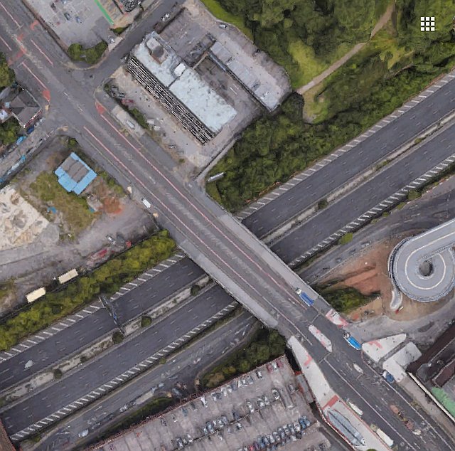
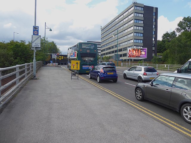
Above is a Google view of the climb out of Stockport on the A6 - Wellington Road North - taken when the current changes were just beginning. There were bus / bike lanes each side which offered cyclists a fairly safe run, especially when making the steep climb northbound; in the 2000s I rode this way to work on many occasions.
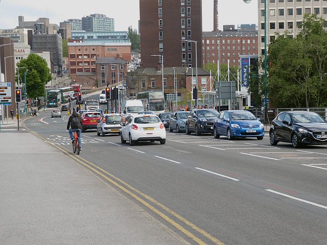
Even allowing for the fact that works seem to be incomplete in come respects, I was not impressed. Above looking down to the town centre crossroads, there is no longer a bus lane except right at the bottom, and the lane has become left-turn-only except buses (and bikes?) creating a risk that vehicles will cut across the path of cyclists going straight on unless they signal right (not easy when you have your brakes on) and cross to the other lane.
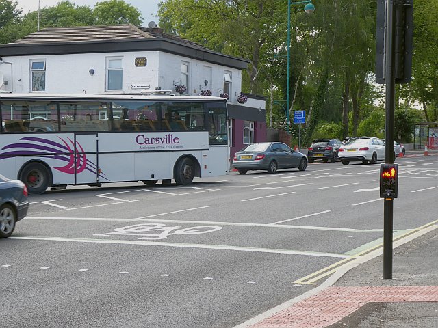
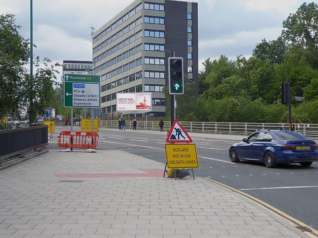
Further up near the pub, there is a Toucan Crossing, which implies that the pavement is intended as a share path, although this is not obviously marked.
Looking down from the crossing, the junction of the new road is seen on the right.
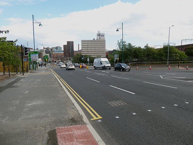
From the other side of the road looking uphill. If this path is intended to be shared, it's not clear what happens at the junction.
Looking up from below the Motorway bridge. This area is very incomplete.
To the Davenport station home page